Run your line.
Know your ground.
Traplines, trap stations, Trap Runs, field journal, weather, regulations, fur-market intelligence and offline field tools — organized in one map-first app built for Canadian trappers.
Everything on your line, in one place.
TrapFinder is designed around how trappers actually work: set, check, log, move, measure, monitor and plan.
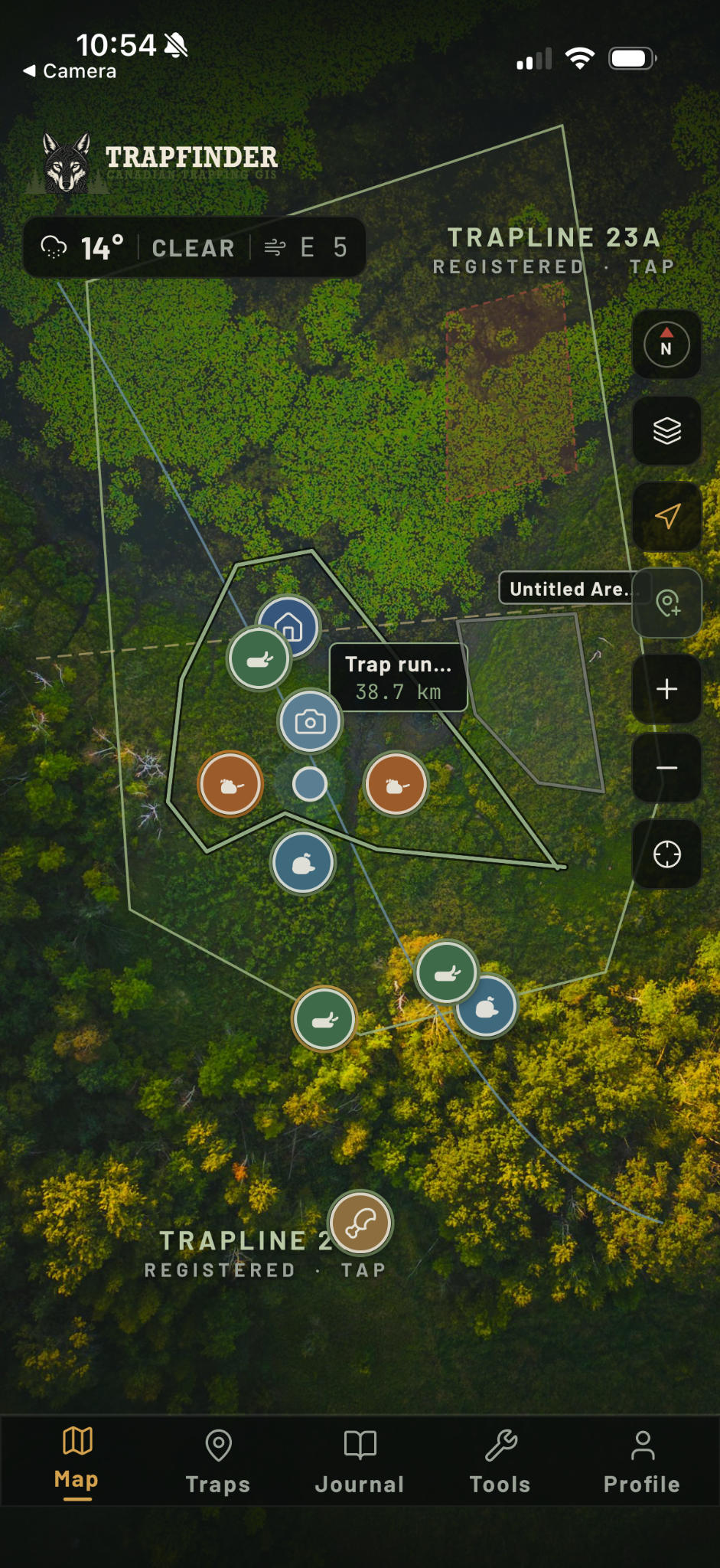
Official trapping boundaries, your trap stations, waypoints, Trap Areas and operational map layers in one working map.
Search, filter and sort traps by status, trapline, species and category so you know exactly what needs attention.
Record the route you actually run by snowmobile, ATV or on foot and keep it tied to your field workflow.
Log catches, tracks, sightings, bait taken, checks, remakes, damage, notes and photos with weather context.
Current conditions, operational warnings, hourly outlooks, 7-day forecast, sun/moon and seasonal field guidance.
Create field packs before you leave service so your working map stays useful where cell coverage does not.
Your line is the dashboard.
TrapFinder keeps the map central. Stations, traplines, runs, areas and field intelligence stay spatial instead of buried in menus.
From trap check to regulation check.
Operational screens are built to give a trapper useful answers quickly without turning the app into a spreadsheet.
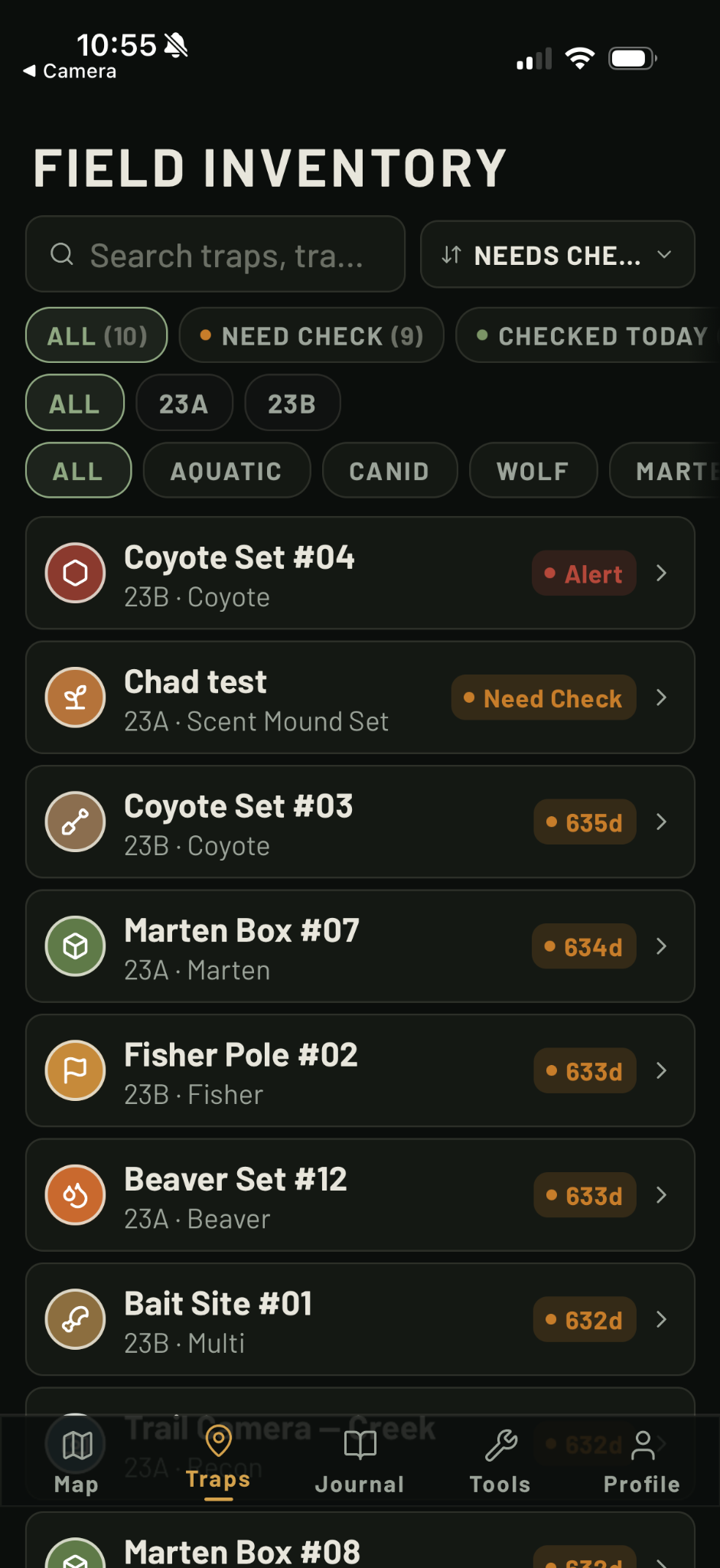
Know what needs checking.
Filter active stations by trapline, category and status, then open station details directly from the list.
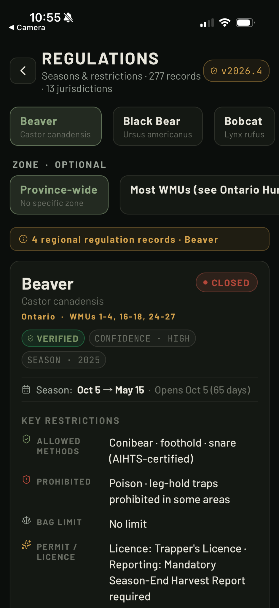
Verified rules by species and zone.
Browse season windows, methods, restrictions, licence notes and status across Canadian jurisdictions.
Development screenshot shown. Regulation data and version labels continue to update before launch.
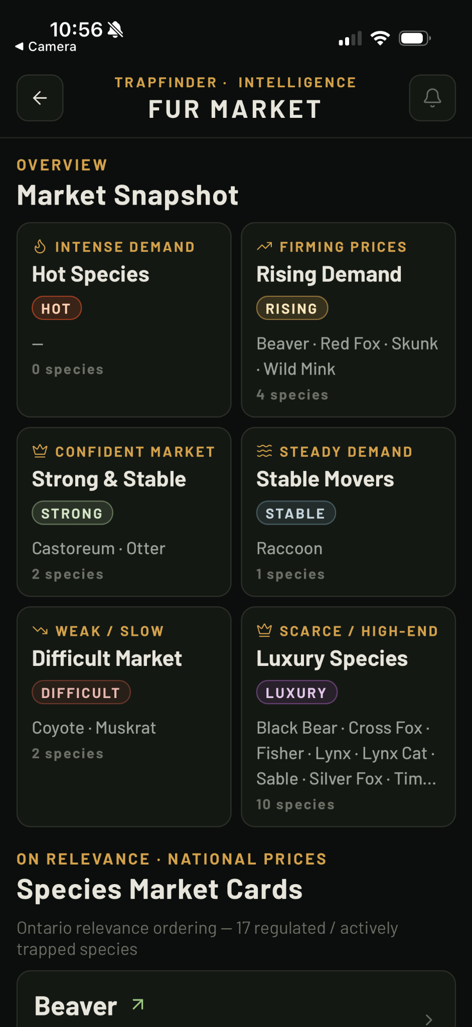
Keep an eye on the market.
National and province-relevant species cards organize demand, market direction and sale intelligence in one place.
Built for actual trapline work.
GPS coordinates, line measurement, Trap Areas, weather, map layers, offline packs, journal photos, trail cameras, cabins and bait sites are part of the working product.
Start simple. Unlock the whole line.
Planned Canadian launch pricing. Store pricing may vary by platform or region.
- 1 trap station
- Basic app access
- Unlimited trap stations
- Unlimited Trap Runs & Trap Areas
- Full Journal & Weather Intel
- Unlimited trap stations
- Unlimited Trap Runs
- Unlimited Trap Areas
- Field Journal
- Weather Intel
- Premium field tools
No free trial is currently advertised. Final feature gating can be adjusted before store launch.
Built for the line.
Not the couch.
TrapFinder is being prepared for iPhone and Android. Join the list for launch updates.
No spam. Unsubscribe anytime.